Outforia Quicktake: Key Takeaways
- The main distinction between cyclones, typhoons, and hurricanes is their geographical location.
- Cyclones are tropical storms found in the South Pacific and Indian Oceans, while typhoons occur in the West or Northwest Pacific, and hurricanes originate in the Atlantic basin, central North Pacific Ocean, or eastern North Pacific.
- All three are rotating, low-pressure storm systems, but extratropical cyclones, which occur in the Northern Hemisphere, are caused by prolonged instability of westerly winds.
- Tropical cyclones need warm ocean water and specific atmospheric conditions to form.
- Hurricane and typhoon intensity levels are measured differently, with hurricane intensity measured using the Saffir-Simpson Hurricane Wind Scale.
Large storm systems originating in tropical or subtropical waters can turn into tropical cyclones, or hurricanes or typhoons.
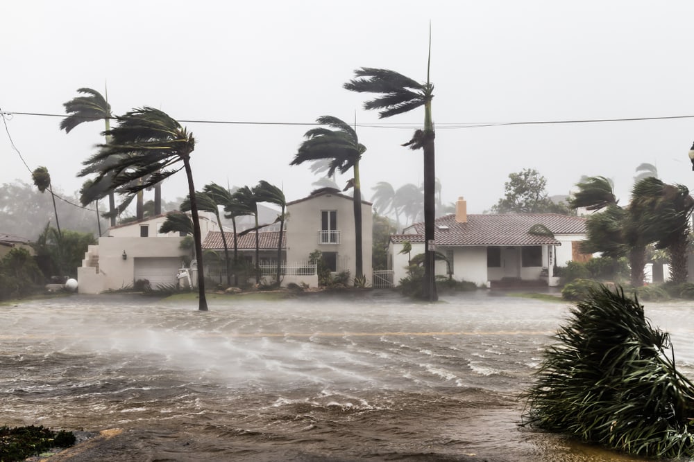
These massive storm systems can bring in damaging winds and torrential rains that can devastate an area. But how does a cyclone vs typhoon vs hurricane differ?
Hurricanes and typhoons are types of tropical cyclones. Tropical cyclone is used as a generic term to describe low pressure systems, which include hurricanes and typhoons. The biggest difference between hurricanes and typhoons is where they form.
We’re going to take a closer look at the characteristics of tropical cyclones, including where and how they form and their classifications and impacts.
You May Also Like: How You Can Stay Safe Camping In Thunderstorm
What is a Cyclone?
The main feature of a cyclone is the center of a rotating storm system that has a low pressure center.
The storm system can rotate either clockwise or counterclockwise depending on where it’s located. Cyclones rotate clockwise in the Southern Hemisphere and counterclockwise in the Northern Hemisphere.
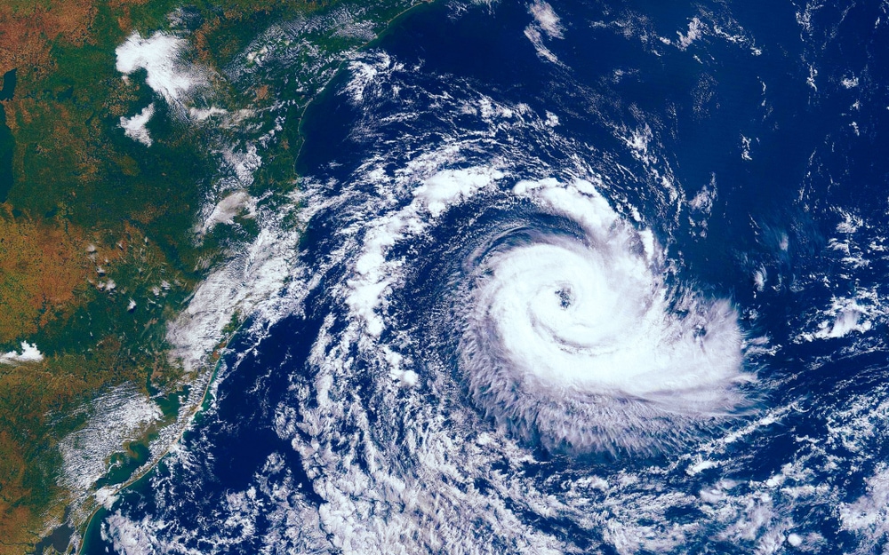
A cyclone is also called a tropical cyclone because they form over subtropical or tropical waters. Warm ocean water is one of the key components for a tropical cyclone to form. Almost all tropical cyclones form near the equator between 5° and 30° latitude.
There are a few conditions needed to form a tropical cyclone including:
- Warm ocean water surface temperature of 80°F (27°C)
- Instability in the atmosphere
- Moist area present in the mid-level of the atmosphere (about 16,000 ft or 4,900 m)
- Close proximity to the equator (5-30° latitude)
- Absence of or low wind shear (little to no change in wind direction or speed)
A low pressure circulating storm system that reaches maximum sustained winds of 74 mph (119 kph) or higher is considered a tropical cyclone.
If the storm system has maximum sustained winds between 39-73 mph (63-117 kph), it’s considered a tropical storm. A tropical depression has maximum sustained winds of 38 mph (61 kph) or less.
What is a Hurricane?
A hurricane is a type of tropical cyclone that forms in the Atlantic basin, the central North Pacific Ocean, or the eastern North Pacific. The Atlantic basin includes the Atlantic Ocean, the Caribbean Sea, and the Gulf of Mexico. Hurricanes rarely ever occur in the South Atlantic.
Hurricanes are most likely to occur between June 1-November 30. This period is known as hurricane season.
Although unlikely, hurricanes can form outside of hurricane season. Peak hurricane activity in the Atlantic basin occurs in September.
Once a rotating low pressure storm system reaches maximum sustained winds of 74 mph, it’s classified as a hurricane.
Hurricanes are classified by the Saffir-Simpson Hurricane Wind Scale. The scale classifies hurricanes based on intensity on a 1-5 category rating system.
The most powerful hurricanes have the ability to reach wind speeds greater than 157 mph (253 kph).
What is a Typhoon?
A typhoon is also a type of tropical cyclone. When a tropical storm forms in the West or Northwest Pacific, it’s referred to as a typhoon.
Typhoon season occurs between May and November. Unlike hurricanes, they’re more likely to occur year-round. Between May and November is considered the peak season. The only time of year when typhoons are extremely unlikely is February and early March.
The most common time for typhoons to occur in the West and Northwest Pacific is late August to early September.
A severe tropical storm becomes a typhoon when it reaches a maximum sustained wind speed of 73 mph (118 kph). It’s classified as a super typhoon when wind speeds reach 115 mph (185 kph) or more.
Typhoon vs Hurricane
A typhoon and hurricane are both tropical cyclones. Typhoons and hurricanes are the same type of weather event. The only difference between the two is location.
East and Southeast Asian countries, such as Taiwan, Japan, and the Philippines, are most vulnerable to typhoons.
Hurricanes mostly affect the Atlantic and Gulf coasts of the southern US. Caribbean Islands, such as Puerto Rico, Cuba, and the Bahamas, also experience hurricanes.
The intensity levels of typhoons and hurricanes are measured differently. The Saffir-Simpson Hurricane Wind Scale is only used to measure the intensity of hurricanes.
Although intensity levels may be similar, typhoons aren’t measured the same way as hurricanes.
Typhoons are categorized into two levels of intensity. Less extreme typhoons would equal a Category 1-3 on the hurricane classification system. Super typhoons would equal to a Category 3-5 hurricane based on maximum sustained wind speeds.
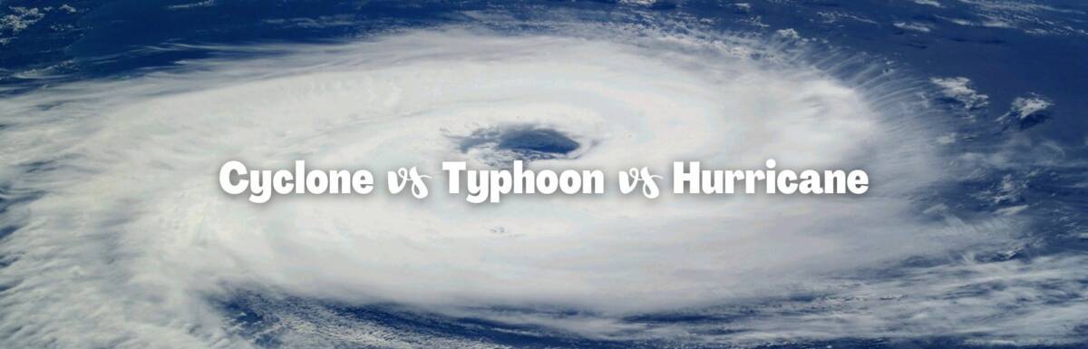
Cyclone vs Typhoon vs Hurricane
The structure and elements of a typhoon and hurricane are the same. Typhoons and hurricanes are just terms used by different regions to describe tropical cyclones.
In some parts of the world, these natural disasters are just called tropical cyclones. Rotating low pressure storm systems with high winds that occur in the South Pacific and Indian Oceans are called tropical cyclones.
Tropical cyclone season in the Australian basin or Southwest Pacific basin occurs between late October and early May. Peak tropical cyclone season in this region is late February to early March.
Extratropical cyclones are another type of cyclone that differ from typhoons and hurricanes. Extratropical cyclones aren’t nearly as common. They don’t occur in the tropics. They typically occur in the Northern Hemisphere north of 35° latitude.
Extratropical cyclones are still low pressure systems, but they’re caused by prolonged instability of westerly winds present at middle and high latitudes. Instability can be caused by temperature changes or fronts.
What is a Tropical Storm?
A tropical storm is an early formation of a tropical cyclone. Not all tropical storms turn into tropical cyclones. If a tropical storm has all of the right conditions, it can become a typhoon or hurricane.
When a tropical cyclone is at its weakest, it’s called a tropical depression. Once maximum sustained wind speeds reach 39 mph (63 km/h), the tropical depression turns into a tropical storm. If maximum sustained winds exceed 73 mph (117 km/h), the tropical storm becomes a tropical cyclone.
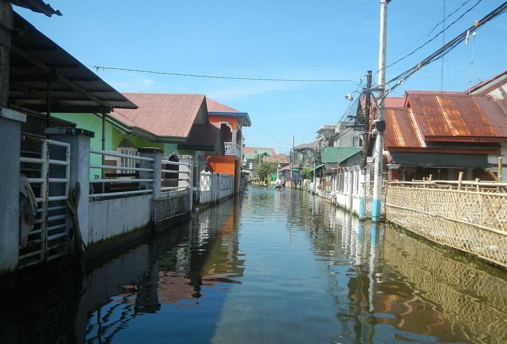
Tropical storms don’t bring in as much rain or high winds as typhoons or hurricanes. When a hurricane or typhoon begins to weaken upon landfall, it can transform back into a tropical storm.
How Do Tropical Cyclones Form?
Tropical cyclones need warm water to build up energy. This is why they almost always form in subtropical and tropical waters.
When warm, moist air travels over subtropical and tropical seas, warm ocean water evaporates.
The water vapor cools as it rises, which leads to condensation. When air condenses, it turns into liquid water droplets. This is what causes clouds to form.
When condensation occurs, heat is released into the atmosphere. Warm air continues to rise and winds develop as moist air is continuously drawn from the ocean.
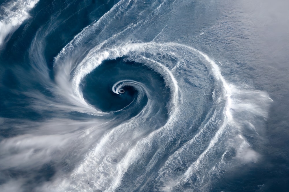
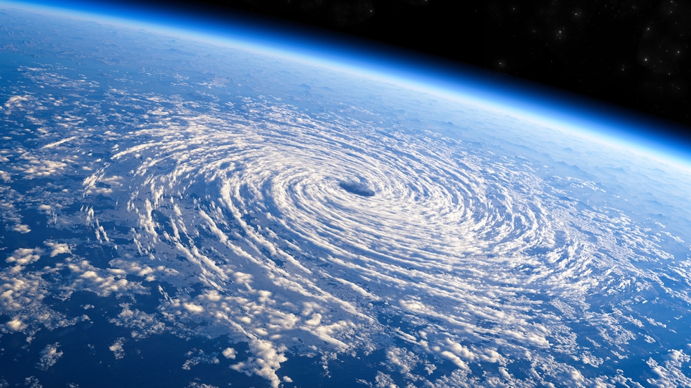
Rising air causes a loss of air at the surface. This causes an area of low pressure to form in the center of a storm system. The surrounding areas of higher pressure move inward into the area of low pressure. A wall of organized thunderstorm clouds surrounds the center.
The higher surrounding air pressure moves to the central low-pressure area in a circular motion. The low-pressure storm system begins to grow as it generates more heat and faster wind speeds.
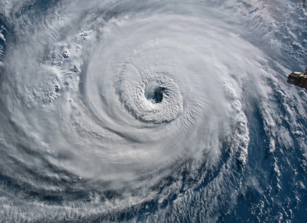
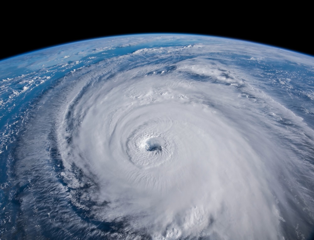
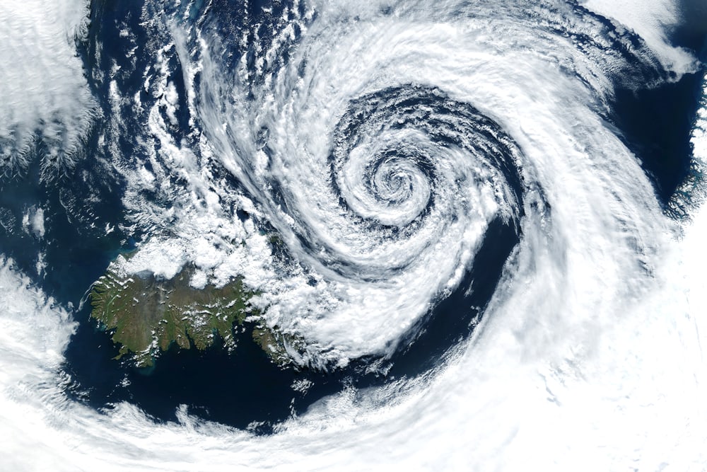
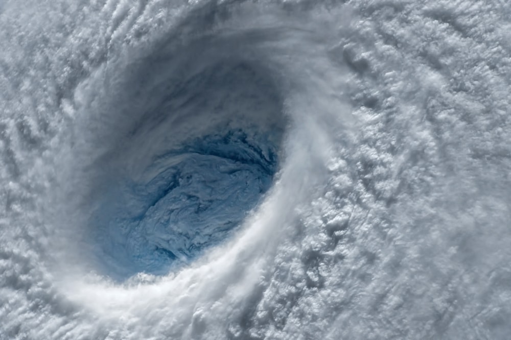
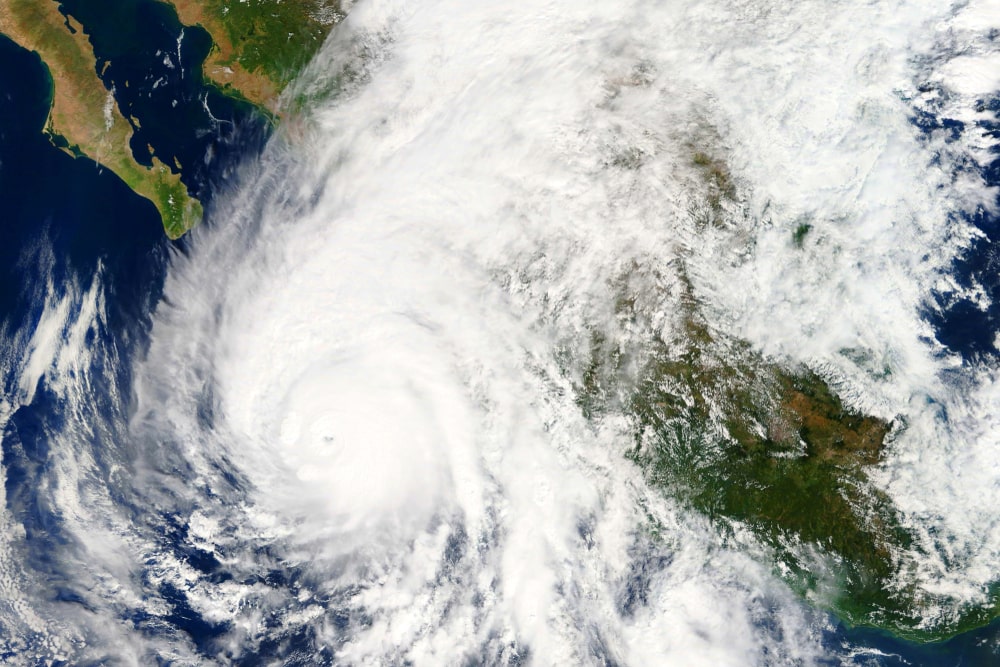
The area of low pressure still remains in the center of the storm system, which is known as the eye. If you’ve ever looked at a satellite view of a tropical cyclone, you may have noticed the eye in the center that lacks clouds.
Tropical cyclones get their power from heat and moisture. To maintain this power, they need warm ocean water.
A tropical cyclone can continue to develop out at sea and grow stronger. Once a tropical storm makes landfall, it begins to lose power and weakens. A tropical cyclone can also die out in the middle of the ocean if it travels over cool ocean water.
You May Also Like: What Is A Tornado? A Fascinating Look At The Science And Impact Of Tornadoes
Parts of a Tropical Cyclone
A tropical cyclone, hurricane, or typhoon is made up of three main parts, which include:
- The eye
- The eyewall
- Rainbands
The eye is the calmest part of a tropical cyclone where the air pressure is the lowest. The eye of a tropical cyclone can be seen clearly in satellite images because it lacks cloud coverage. Unlike the other parts of a tropical cyclone, the eye also has relatively calm winds.
The surrounding area of the eye is called the eyewall. High winds and organized thunderstorm systems are present in the eyewall.
The rainbands are located on the outer part of a tropical cyclone system. The clouds fan out as a result of the storm’s rotating motion.
When rainbands pass over an area, weather conditions can widely vary. Sometimes rainbands can bring in high-speed winds and heavy rainfall. The rainbands have gaps in them, which may include little to no rain or wind.
The size of a tropical cyclone can vary. Some are much smaller than others. Larger storm systems can be up to 400 miles (644 km) wide and 6 miles (10 km) high.
The size of a tropical cyclone doesn’t necessarily indicate its intensity level. Smaller tropical cyclones can still be very powerful. The intensity of the storm ultimately depends on the conditions that provide the storm with energy.
Hurricane Classification System
The Saffir-Simpson Hurricane Wind Scale categorizes hurricanes into a 1-5 rating system based on intensity. The aftermath of a hurricane, such as storm surge and flooding, isn’t factored into the rating.
Each hurricane category (CAT) has different levels of intensity. CAT 1 hurricanes are the weakest. CAT 5 hurricanes often cause catastrophic damage if they make landfall.
CAT 1 Hurricane
A CAT 1 hurricane is the weakest in terms of intensity. Once a tropical storm reaches maximum sustained winds of 74 mph, it becomes a CAT 1 hurricane. A CAT 1 can have wind speeds between 74-95 mph (119-153 kph).
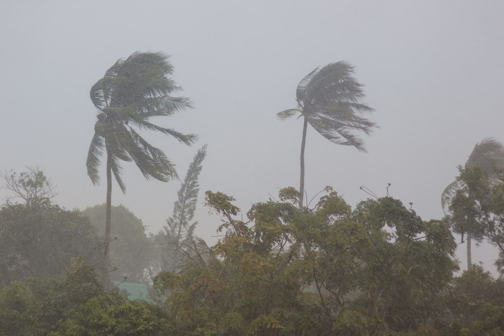
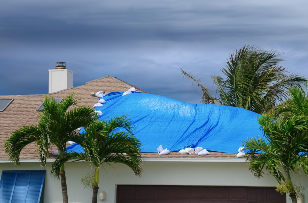
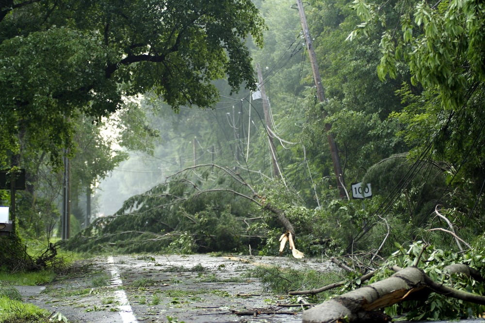
High winds can cause some damage to poorly constructed homes or older mobile homes. Flying or falling debris may contribute to the damage.
Tree branches are likely to snap off and some shallow-rooted trees may fall over. Power outages may occur in some areas and last a few days.
CAT 2 Hurricane
Once a hurricane reaches maximum sustained winds of 96-110 mph (154-177 kph), it becomes a CAT 2. This intensity level usually causes shallow trees to be uprooted. It can also cause large branches to fall.
Power outages in many areas are likely to occur. Restoration of power may take a few days to a couple weeks.
CAT 3 Hurricane
A hurricane that has reached maximum sustained winds of 111-129 mph (179-208 kph) is classified as a CAT 3.
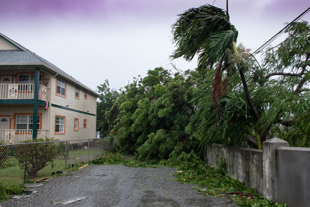
Flying and falling debris may occur due to high winds, which can damage homes. Trees are likely to snap or be uprooted. Fallen trees can block roads and damage power lines.
Power outages and water shortages are very likely. Power may not be restored for days or a few weeks following the storm.
CAT 4 Hurricane
A hurricane is classified as a CAT 4 when it’s reached maximum sustained winds of 130-156 mph (209-251 kph). CAT 4 hurricanes have the potential to cause a significant amount of destruction to infrastructure and trees.
Trees are very likely to be uprooted or snapped and may fall on power lines. Poorly constructed and older homes are likely to be destroyed. New or well-built homes are likely to experience significant damage. Falling or flying debris can contribute to window or roof damage.
Power outages and water shortages are extremely likely. A CAT 4 hurricane can cause regions in the heart of the storm to be out of power for weeks or even months.
CAT 5 Hurricane
A CAT 5 hurricane is the highest hurricane intensity level. Hurricanes are classified as a CAT 5 when they reach maximum sustained winds of 157 mph (252 kph) or greater.
According to the National Weather Service, a CAT 5 hurricane will cause catastrophic damage to affected areas.
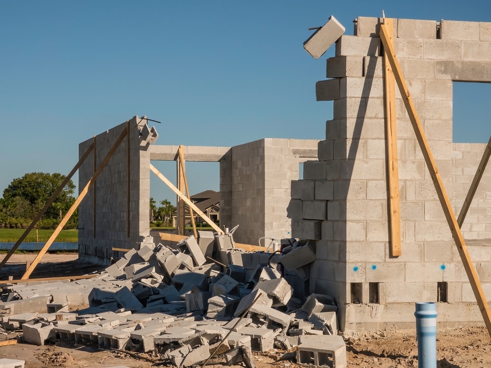
Most mobile homes and many frame homes are likely to be destroyed or suffer major damage. Roof failure and wall collapses are extremely likely.
Most trees are likely to fall, which can cause many power outages across the area. Long-term power outages and water shortages may last for weeks or months.
If a CAT 5 hurricane is expected to make landfall, it’s likely that a mandatory evacuation procedure will be put in place. CAT 5 hurricanes have the ability to make an area uninhabitable and isolated for weeks or months.
Historical Tropical Cyclones
Tropical cyclones can reach catastrophic wind speeds and bring in torrential rainfall that can devastate an area.
Some of the most notable tropical cyclones in history have caused an immense amount of damage due to wind damage, flash flooding, and storm surge.
Hurricane Patricia

Hurricane Patricia was spotted by NASA’s Terra satellite in the eastern Pacific on October 23, 2015 as a CAT 5 hurricane. The hurricane was a very intense storm that developed rapidly. At the time it was first observed, it had maximum sustained winds of 200 mph (325 kph).
The extremely high wind speed made Hurricane Patricia one of the strongest tropical cyclones ever recorded in the Atlantic and eastern Pacific.
The eye of Hurricane Patricia was less than 100 miles (161 km) away from Manzanillo, Mexico when it was first observed. It later made landfall in southwest Mexico.
The tropical cyclone lasted about 4 days. Heavy rainfall, flash floods, and mud slides were major threats associated with the storm.
Hurricane Katrina
Hurricane Katrina was one of the several tropical cyclones a part of the peak hurricane activity in 2015. It holds the record for the most costly hurricane to ever hit the US due to extensive damage.
According to the National Weather Service, Hurricane Katrina was also one of the top 5 deadliest hurricanes in US history.
Hurricane Katrina started as a tropical depression in the southeastern Bahamas on August 23, 2015. By the next day, it had developed into a tropical storm. It was a CAT 1 hurricane when it made landfall on the southeast coast of Florida.
Although making landfall can weaken a hurricane, Katrina moved course towards the Gulf of Mexico. The warm waters provided more energy for Hurricane Katrina to intensify to a CAT 5. The strongest sustained winds reached 175 mph (282 kph).
It weakened by August 28 to a strong CAT 3 when it made landfall on the Gulf coast of Louisiana and then Mississippi. Although it had weakened, Hurricane Katrina still caused a significant amount of damage to the affected areas.
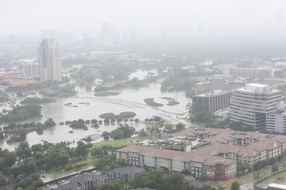
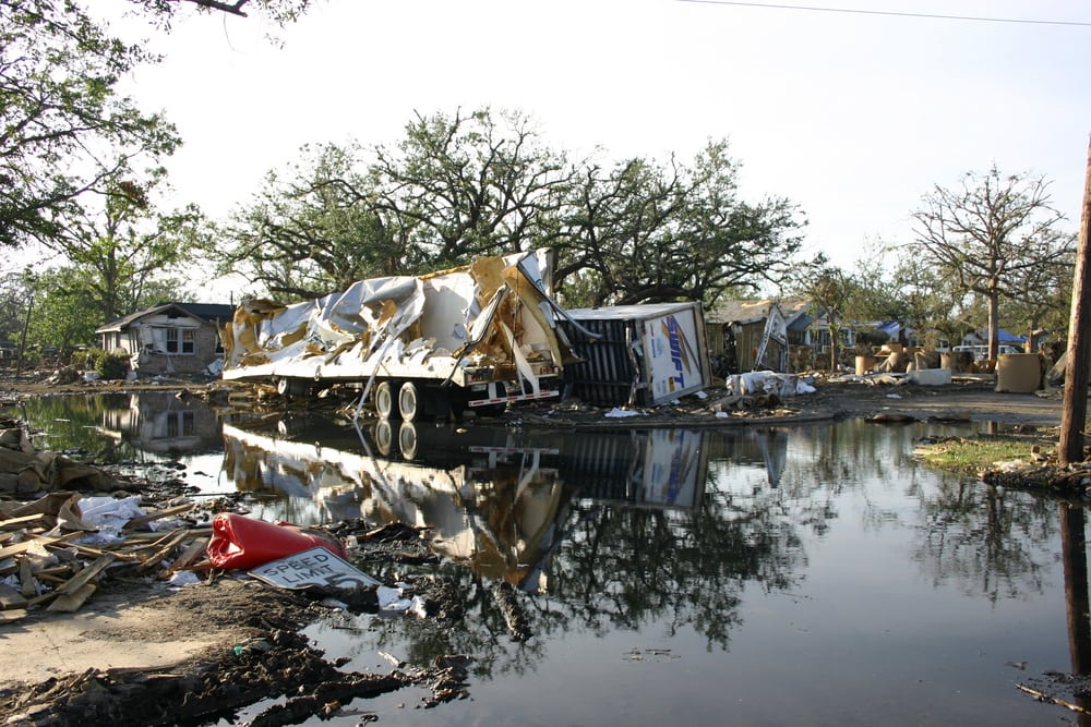
It resulted in a very high storm surge and caused major destruction to many homes. It’s estimated that it caused $108 billion in damage and 1,833 fatalities.
Hurricane Wilma
Hurricane Wilma was first observed as a tropical depression on October 15, 2015 near Jamaica. It became a tropical storm on October 17. It developed into a hurricane the following day. On October 19, it became a CAT 5 hurricane.
Hurricane Wilma broke the record for the lowest central pressure for a hurricane in the Atlantic basin at 882 millibars. The central pressure of a hurricane indicates its intensity level.
Hurricanes with low central pressure are considered more intense and stronger. But some hurricanes with low central pressure have slower wind speeds than hurricanes with higher central pressure. Its maximum sustained winds reached 175 mph (280 kph).
The hurricane weakened to a CAT 3 by the time it made landfall in South Florida on October 24.
The eye of Hurricane Wilma was measured at 55-65 miles (89-105 km) wide. The highest level of storm surge forecasted on the mainland was 13-18 ft (4-5.5 m) in Monroe County.
Galveston, Texas Hurricane
The Galveston Hurricane, also named the Great Galveston Hurricane, was one of the deadliest hurricanes in US history.
The hurricane made landfall in Galveston, Texas on September 8, 1900.
It’s estimated that it had 130-140 mph (209-225 kph) sustained winds. The storm surge was measured as at least 15 ft (4.5 m). It developed into a CAT 4 that caused 8,000-12,000 deaths. Tens of thousands of people lost their homes in the catastrophic tropical cyclone.
Tropical Cyclone Hyacinthe
Tropical Cyclone Hyacinthe holds the record for the highest amount of precipitation recorded as a result of a tropical cyclone.
The storm system developed in the southern Indian Ocean in January 1980. The tropical cyclone changed paths multiple times. This caused the island of La Réunion to receive a significant amount of rainfall.
According to the Atlantic Oceanographic & Meteorological Laboratory (AOML), it’s estimated that it produced at least 239.5 inches (608.3 cm) of rainfall.
Towards the end of its life, Tropical Cyclone Hyacinthe became an extratropical cyclone as it changed directions before weakening.
Bhola Cyclone
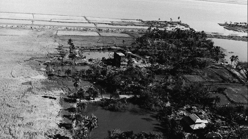
According to the AOML, the deadliest tropical cyclone on record is the Bhola Cyclone of 1970. The storm system developed into a tropical depression in the Bay of Bengal in mid-November 1970.
It caused an extremely devastating storm surge in coastal Bangladesh, which resulted in at least 300,000 deaths. At the time of landfall, the tropical cyclone was the equivalent to a CAT 3 hurricane.
Super Typhoon Rolly
One of the most recent catastrophic tropical cyclones occurred in 2020 near Catanduanes Island in the Philippines. The tropical cyclone is referred to as Typhoon Goni or Super Typhoon Rolly.
The super typhoon made landfall in the province of Bato as a CAT 5-equivalent tropical cyclone. It had estimated maximum sustained winds of 195 mph (314 kph). It also had a very low central pressure of 884 millibars.
The combination of high-speed winds and lower central pressure made this an extremely intense storm. It’s considered one of the strongest tropical cyclones in world history.
You May Also Like: All About The 4 Types Of Volcanoes+ Formation, Eruption, And Facts
FAQ
What is the strongest cyclone ever recorded?
Various types of measurements are used to determine the strength of a tropical cyclone. The strongest tropical cyclone recorded in the Atlantic and eastern Pacific, in terms of sustained winds, was Hurricane Patricia.
In the same region, the tropical cyclone that had the strongest level of intensity was Hurricane Wilma. The most recent
Where do typhoons occur the most?
According to The Weather Channel, countries in Asia experience the most tropical cyclones compared to other regions around the world.
Since typhoon season is much longer than hurricane season, the likelihood of typhoons occurring is higher.
China has the second highest number of tropical cyclones on record. The Philippines has the second highest number of tropical cyclones, or typhoons, recorded. Since typhoons occur in the West and Northwest Pacific, this doesn’t include hurricanes.
Which country has the most hurricanes?
The US experiences the most tropical cyclones, or hurricanes, compared to any other country.
Since tropical cyclones are considered hurricanes in Mexico, it ranks second in the most hurricanes recorded.